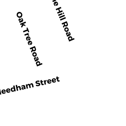
60 CUNNINGHAM RD
Owner Information
RENA MCKAY IRREV TRUST
60 CUNNINGHAM RD
DEDHAM, MA 02026


Property Details
60 CUNNINGHAM RD is classified as a Single Family Residential (Ranch).
The primary structure on this property was built in 1971. There are 5,234ft2 of built area within this property. There is 2,511ft2 of residential/living space within this property. This property is listed as having 9 rooms.
60 CUNNINGHAM RD is valued at $677,700. The land is valued at $289,200 and the structures are valued at $373,300. There is an additional valuation of $15,200 on this property.
This property is in Zone B. Confirm with local Zoning Board authorities to ensure there are no overlays or other easements on this property.
60 CUNNINGHAM RD was last sold on Wednesday, October 18, 2017 for $100.
Assessment data from fiscal year 2020.
Flood Data
According to the FEMA National Flood Hazard Layer, this property does not appear to be in a flood zone. It may also be in an area not yet reviewed. Nonetheless, confirm this information prior to taking any action.
To view the flood hazards around this property, create a FEMA "Firmette" Map of the area around 60 CUNNINGHAM RD.
Broadband Internet Providers
| Provider | Type | Bandwidth (mbps) | |
|---|---|---|---|
| Viasat Inc | Satellite | 100 | 3 |
| Verizon New England Inc. | DSL | 5 | 0 |
| Verizon New England Inc. | Fiber | 940 | 880 |
| Comcast | Cable | 1000 | 35 |
| RCN | Cable | 500 | 20 |
| GCI Communication Corp. | Satellite | 0 | 0 |
| RCN | Cable | 1000 | 20 |
| VSAT Systems, LLC. | Satellite | 2 | 1 |
| HughesNet | Satellite | 25 | 3 |
Broadband service provider data from December 2020.
Adjacent Properties
- 54 CUNNINGHAM RD
Single Family Residential owned by DAKOYANNIS LOUIS J ETUX - 187 NEEDHAM ST
Two-Family Residential owned by MCDONAGH JAMES ETUX - 195 NEEDHAM ST
Single Family Residential owned by BOUTALIS ELIZABETH - 199 NEEDHAM ST
Single Family Residential owned by 199 NEEDHAM ST REALTY TRUST - 68 CUNNINGHAM RD
Single Family Residential owned by MACIOCE MAUREEN ETAL